- Get link
- X
- Other Apps
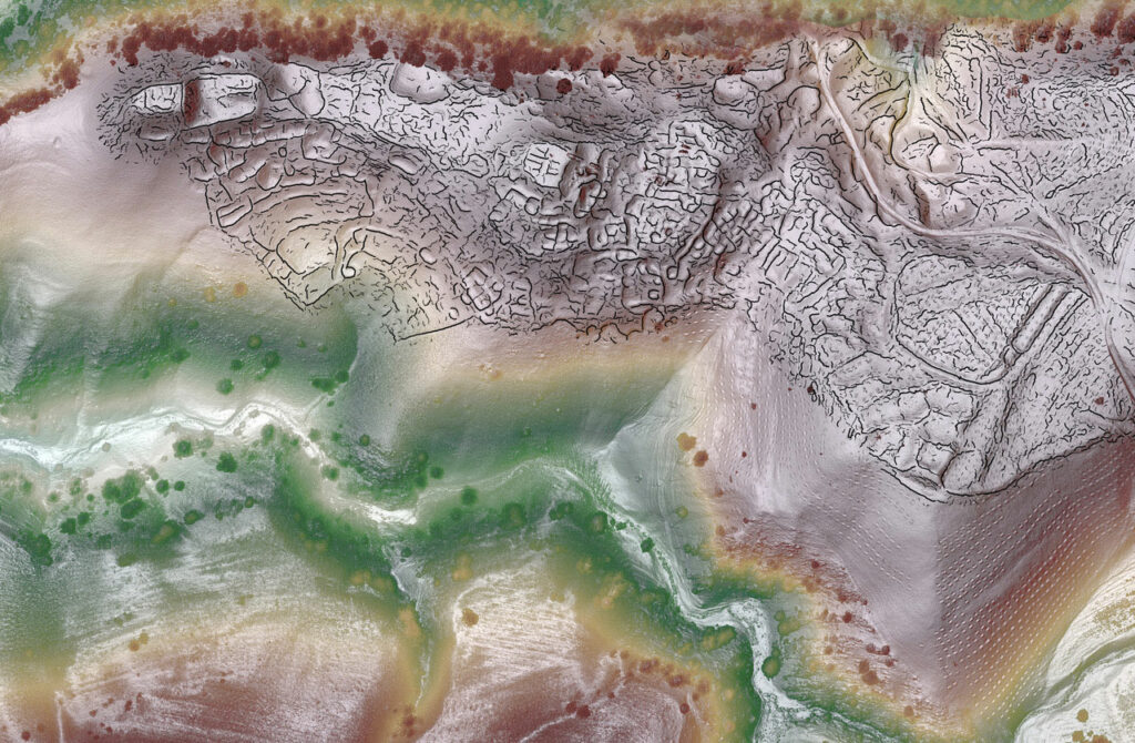
Recent lidar surveys have uncovered intriguing evidence that two medieval towns, Tashbulak and Tugunbulak, located about three miles apart in the mountains of Uzbekistan, may have eventually evolved into a single large urban center. According to archaeologist Michael Frachetti from Washington University in St. Louis, the towns were situated at elevations of around 6,500 and 7,200 feet above sea level. Tashbulak, which covered 30 to 40 acres, was inhabited between the eighth and eleventh centuries, while Tugunbulak was occupied from the sixth to the eleventh centuries.
Using remote sensing technology, an international research team discovered over 300 structures across the site, including watchtowers connected by walls along a ridgeline, traces of terracing, and a central fortress surrounded by stone and mudbrick walls at Tugunbulak. These findings suggest that, as Tashbulak developed, the two towns may have been interconnected as part of a larger urban network.
Frachetti envisions the towns as integral parts of a broader urban landscape, likely playing a significant role along the Silk Road trade route that connected the Mediterranean to China. This discovery offers new insights into the urban dynamics of medieval Central Asia. What do you think the connection between these towns reveals about trade and urbanization in the region during this period?